Amalfi Maps and Orientation
(Amalfi, Campania, Italy)
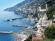
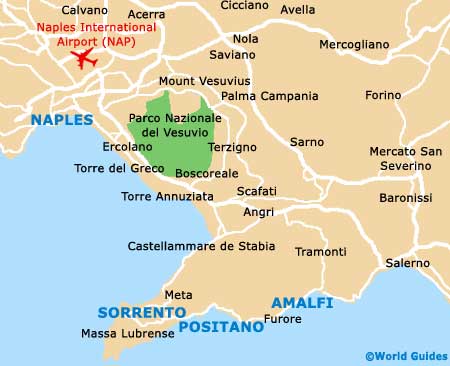
One of the most notable towns on Italy's Amalfitana coastline, Amalfi lies within the province of Salerno and has grown into nothing short of a tourist hotspot. There are so many important cities close to Amalfi, making the town ideally placed to explore this part of Italy.
Within easy reach of Amalfi are both Naples and Sorrento, which are two of the main cities. Somewhat smaller although extremely close are Atrani, Positano and Ravello, amongst many others.
Maps and Orientation of the Town
The town centre is based around three very prominent public squares, the Piazza Flavio Gioia, the Piazza dei Doga and the Piazza Duomo. In particular, the Piazza Duomo is very central to life in Amalfi, and is surrounded by a large concentration of restaurants and hotels, which line the adjacent Via Lorenzo d'Amalfi.
The best place to obtain maps of Amalfi is the town's very own tourist office, which resides on the Corso Repubbliche Marinare, being located next to the Post Office and directly opposite the Marina Grande.
- Bari - 262 km / 163 miles (three hours and 10 minutes, east)
- Benevento - 97 km / 60 miles (one hour and 40 minutes, north)
- Campobasso - 161 km / 100 miles (two hours and 25 minutes, north)
- Caserta - 87 km / 54 miles (one hour and 30 minutes, north-west)
- Cava de Tirreni - 25 km / 16 miles (30 minutes, north-east)
- Cerignola - 179 km / 111 miles (two hours and 35 minutes, north-east)
- Foggia - 177 km / 110 miles (two hours and 30 minutes, north-east)
- Giugliano in Campania - 85 km / 53 miles (one hour and 30 minutes, north-west)
- Naples (Napoli) - 72 km / 45 miles (one hour and 15 minutes, north-west)
- Paestum - 65 km / 40 miles (one hour and 15 minutes, south-east)
- Pescara - 347 km / 216 miles (four hours and 10 minutes, north)
- Pompeii - 46 km / 29 miles (50 minutes, north-west)
- Positano - 16 km / 10 miles (20 minutes, west)
- Potenza - 127 km / 79 miles (one hour and 50 minutes, east)
- Ravello - 7 km / 4 miles (10 minutes, north)
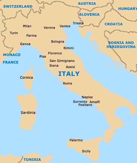
- Rome (Roma) - 282 km / 175 miles (three hours and 10 minutes, north-west)
- Salerno - 24 km / 15 miles (30 minutes, east)
- Sorrento - 31 km / 19 miles (40 minutes, west)
Map of Italy
Map of Amalfi